
GIS and Digital Mapping
Geographic Information System (GIS) is a technology used to collect, store, manage, analyse and display information that is connected to a location on the Earth’s surface. This makes GIS useful in land management, surveying, urban and regional planning, environmental management, infrastructure development, agriculture, transportation, disaster management, natural resource management and many other fields.
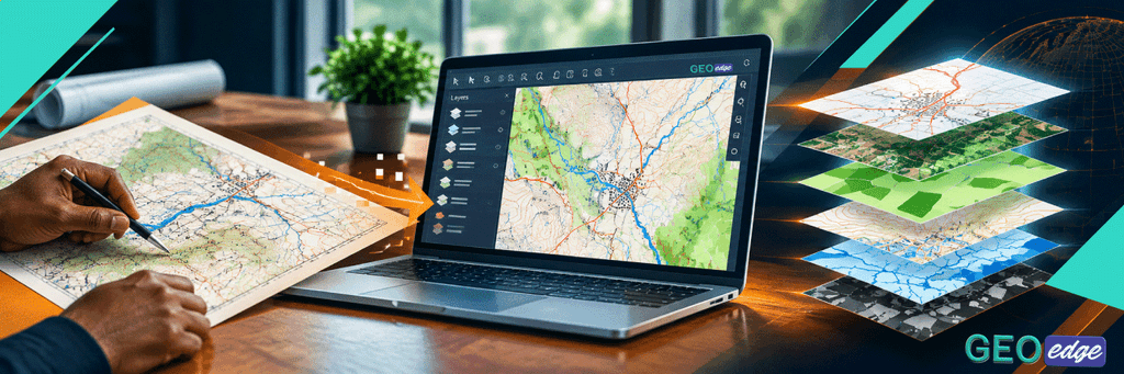
Digital mapping is the process of creating, editing, managing and presenting maps in digital form using GIS, CAD, satellite imagery, aerial imagery, GPS/GNSS data and other geospatial technologies. It goes beyond simply drawing a map and it involves creating spatial information that can be updated, analysed, queried and reused.
GIS & Mapping
GIS Mapping
GIS mapping involves using GIS software to create maps that combine geographic features with associated information. Instead of treating a map as a picture, GIS treats it as a collection of spatial features and their associated data.
Our GIS mapping services include: Creation of new GIS maps, Mapping of land parcel, Land-use mapping, Infrastructure mapping, Environmental mapping, Administrative boundary mapping, Integration of survey and GIS data, Updating existing GIS datasets and Preparation of professional map layouts The final product can be delivered in formats appropriate to the client’s needs, including GIS datasets, CAD files, PDFs, web maps and other digital formats.
Digital Mapping
Digital mapping focuses on converting spatial information into usable digital maps and datasets. It may involve collecting, processing, editing and presenting geographic information from several sources. It can also involve extracting features from aerial or satellite imagery. The objective is to create spatial information that accurately represents the area being mapped and can be used for planning, analysis or decision-making.
Thematic Mapping
A thematic map focuses on a particular subject or theme rather than simply showing general geographic features. Thematic mapping is particularly useful when large amounts of information need to be communicated clearly. Instead of presenting a spreadsheet containing thousands of records, a thematic map can help the user see where the patterns occur.
Spatial Analysis
Spatial analysis is one of the most powerful capabilities of GIS. It involves examining geographic data to identify patterns, relationships, distances, concentrations, changes and suitability. In simple terms, spatial analysis helps answer: What does the location of something tell us? These are some of the spatial analysis we offer as GeoEdge land surveyors;
- Proximity Analysis; Determining what is within a particular distance of a feature.
- Buffer Analysis; Creating zones around geographic features.
- Overlay Analysis; Combining multiple spatial layers to identify relationships.
- Network Analysis; Analysing movement through a road or transportation network.
- Terrain Analysis; Using elevation data to analyse:
- Change Detection;Comparing spatial data from different dates to identify changes.
Cartography
Cartography is the science and practice of designing and producing maps. GIS provides the tools for managing and analysing geographic information, while cartography focuses strongly on how that information is communicated visually. At GeoEdge, we aim to ensure that our maps are not only technically correct but also clear, readable and fit for their intended purpose.
Geodatabase Development
A geodatabase is an organised system for storing, managing and working with geographic data and its associated information. Instead of having separate files scattered across different folders, related spatial information can be organised within a structured database.
At GeoEdge, we first understand what the client needs the database to accomplish. This allows us to develop a geodatabase that is designed around the client’s actual workflow rather than simply creating a collection of spatial files.
Data Digitization
Data digitization is the process of converting information from analogue, paper-based, scanned or non-digital sources into usable digital data. Old survey documents and maps can be converted into digital spatial data through processes such as scanning, georeferencing and digitization. Digitization is not simply tracing lines. The resulting dataset needs to maintain appropriate: Spatial accuracy, Attribute accuracy, Feature relationships, Topology, Coordinate reference system and Data structure.
GPS/GNSS Data Processing
GPS and GNSS technologies allow us surveyors and GIS professionals to determine the geographic position of features on the Earth’s surface. Field equipment can collect coordinates for points and features but collecting coordinates is only part of the process.
Our workflow may include:
Field Data → Data Download → Quality Check → Coordinate Processing → Coordinate Transformation, Where Required → GIS/CAD Integration → Mapping → Final Quality Control
The processed data can then be integrated into GIS or CAD environments depending on the project’s requirements.
GIS & MAPPING
Our Approach to GIS and Digital Mapping
At GeoEdge Land Surveyors, we believe that GIS mapping should not begin with software. It should begin with understanding the client’s problem. Before starting a project, we establish what the client wants to achieve, what information is available and how the final data or map will be used. Our general workflow is:
- 1. Understand the Client’s Requirement; This allows us to select an appropriate methodology rather than applying the same workflow to every project.
- 2. Identify and Collect the Data; Where new field information is required, we use appropriate survey and data-collection methods.
- 3. Coordinate Reference System and Georeferencing; Spatial data must be correctly positioned. We therefore establish the appropriate coordinate reference system (CRS) and ensure that different datasets are correctly aligned. This is particularly important when combining survey data, satellite imagery, CAD drawings and existing GIS layers.
- 4. Data Processing and Preparation; Raw data is rarely ready for immediate use. We clean, structure and process the data before analysis.
- 5. GIS Analysis and Mapping; Once the data is prepared, we perform the required analysis. The results are then presented through appropriate maps, datasets, reports or other outputs.
- 6. Cartographic Design; We carefully design the final maps so that the information is easy to understand. The objective is to produce a map that communicates information clearly rather than simply displaying data.
- 7. Quality Control; Quality control is an important part of our workflow because a visually attractive map is not useful if the underlying information is incorrect.
- 8. Deliverables; The final format is selected according to how the client intends to use the information.
Bringing Surveying and GIS Together
One of GeoEdge’s strengths is the ability to work across land surveying and GIS. Surveying provides accurate information about positions, boundaries, elevations and physical features.
GIS provides the tools to organise, analyse, visualise and manage that information. When combined effectively, they can provide a much more complete understanding of land and its surroundings. Rather than treating these as isolated activities, we can integrate them into a coordinated geospatial workflow.
Why Choose GeoEdge for GIS and Digital Mapping?
At GeoEdge Land Surveyors, our approach is built around accuracy, purpose and usability. We do not believe that GIS is simply about producing colourful maps or converting information into digital files. The real value lies in creating reliable spatial information that helps people understand their land, assets, environment and surroundings and make informed decisions.
Whether you need a simple location map, a detailed GIS database, digitization of existing plans, GPS/GNSS data processing, spatial analysis or a complete mapping solution, we tailor the approach to the requirements of the project.
Need professional support?
Contact GeoEdge Land Surveyors to discuss your project requirements.