
Land Surveyor in Kitengela: What Landowners Need to Know Before Hiring One
Buying land, building a home, subdividing property, or resolving a boundary issue often starts with one important question: Where exactly is the land, and are the boundaries correct? This is where a qualified land surveyor in Kitengela comes in.
With Kitengela and the surrounding areas continuing to experience rapid development, landowners are increasingly seeking professional land survey services in Kitengela for property purchases, boundary identification, subdivision, beacon reinstatement, topographical surveys, and other land-related services.
However, choosing a surveyor should not simply be about finding the cheapest quotation. A survey is an important step in protecting your investment, and the quality of the work can affect your property, development plans, and even future legal transactions. If you are looking for a land surveyor in Kitengela, here are some of the key things you should know before hiring one.
Why You May Need a Land Surveyor in Kitengela
There are several situations where professional surveying becomes necessary.
You may need a surveyor when:
- Buying or selling land
- Confirming the location of a parcel
- Establishing or verifying property boundaries
- Re-establishing missing or disturbed beacons
- Subdividing land
- Amalgamating parcels
- Preparing land for development
- Carrying out a topographical survey
- Preparing plans for construction
- Investigating a possible boundary encroachment
- Confirming the position of a road reserve or other public feature
- Supporting land due diligence
- Preparing survey documentation for further land transactions
For example, a title deed may tell you the registered size and parcel number, but it does not necessarily answer every question you may have about what is physically on the ground. A professional survey helps connect the legal information about the property with its physical position on the ground.
What Does a Land Surveyor Actually Do?
Many landowners think surveying simply involves placing beacons on the ground. While beaconing is an important part of surveying, professional land surveying involves much more. Depending on the type of survey, a surveyor may:
- Review the available land documents.
- Carry out the necessary searches and checks.
- Obtain and examine relevant survey records.
- Visit the property and identify existing survey control and boundary evidence.
- Take measurements using appropriate survey equipment.
- Compare field observations with available records.
- Calculate and analyse the survey data.
- Identify discrepancies or possible encroachments.
- Prepare survey plans, maps, coordinates, or reports where required.
- Advise the client on the appropriate next steps.
The exact process depends on the service required and the circumstances surrounding the property.
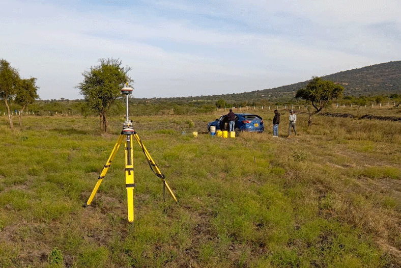
What Should You Check Before Hiring a Land Surveyor in Kitengela?
1. Make Sure You Are Hiring a Qualified Professional
This should be your first consideration. Land surveying involves technical measurements as well as professional and legal responsibilities. Before engaging a surveyor, ask about their professional qualifications, registration, and experience.
Do not be afraid to ask questions such as: “Are you a registered and licensed surveyor?”. A professional should be comfortable providing information about their qualifications and professional standing.
2. Look at Their Experience With Similar Survey Work
Not every survey is the same. A surveyor who has extensive experience with topographical surveys may not necessarily be the best person for a complicated boundary dispute or subdivision project. Ask whether they have handled work similar to yours.
For example, if you need to subdivide land in Kitengela, ask about their experience with subdivision surveys and the preparation of the necessary survey documentation. If your concern is a boundary issue, ask about their experience with boundary verification, beacon reinstatement, and boundary-related investigations. Experience with the specific type of work can make a significant difference.
3. Explain Your Problem Clearly
Before requesting a quotation, explain what you actually need. For instance, there is a difference between saying: “I want a land survey.” and saying: “I have a parcel in Kitengela, some of the boundary beacons are missing, and I want the boundaries verified and the missing beacons reinstated.”
The second explanation gives the surveyor a much better understanding of the assignment. If possible, provide:
- Parcel number
- Location
- Title deed or ownership documents
- Existing survey plans
- Previous mutation forms
- Any available deed plans
- Previous survey reports
- A sketch or directions to the property
- Details of the problem you are experiencing
The more information your surveyor has at the beginning, the easier it is to determine the appropriate survey procedure.
Don’t Choose a Surveyor Based on Price Alone
Cost is naturally important when hiring a professional, but the cheapest survey quotation is not always the best option. A very low quotation may not include everything you expect. When comparing quotations, ask:
- What exactly is included?
- Will the surveyor provide a report?
- Are coordinates included?
- Are beacon materials included?
- Is the survey plan included?
- Are government or official search fees included?
- Are additional site visits included?
- Are there any other costs that may arise?
A professional quotation should make the scope of work reasonably clear. The goal is not necessarily to find the cheapest surveyor. It is to find a qualified professional who can deliver the required work properly and transparently.
Ask What Survey Equipment Will Be Used
Modern surveying relies heavily on technology. Depending on the project, a surveyor may use equipment such as:
- GNSS/RTK receivers
- Total stations
- Digital levels
- Survey data collectors
- Appropriate GPS equipment
- CAD and GIS software

However, equipment alone does not determine the quality of a survey. A sophisticated instrument in the hands of an inexperienced operator can still produce poor results. What matters is the combination of appropriate equipment, sound surveying methodology, qualified personnel, proper data processing, and professional judgment.
Understand That GPS Coordinates Alone May Not Solve Your Boundary Problem
This is an important point for landowners. A client may sometimes request: “Just give me the GPS coordinates of my beacons.”
Coordinates can be useful, but determining the correct boundary position may require more than simply collecting a point with a handheld GPS. A professional boundary survey may require examination of survey records, existing boundary evidence, control points, neighbouring parcels, measurements, computations, and other relevant information. For property matters where accuracy is important, make sure the surveyor understands the purpose for which the coordinates will be used.
Ask for a Clear Deliverable
Before the survey begins, understand what you will receive when the work is completed. Depending on the assignment, deliverables may include:
- Survey report
- Site sketch
- Survey plan
- Coordinates
- Beacon schedule
- Topographical map
- Contour plan
- CAD drawings
- Digital files
- Photographs
- Relevant survey documentation
Not every survey requires all of these. Your surveyor should explain which deliverables are appropriate for your particular assignment.
What If Some Beacons Are Missing?
Missing or disturbed beacons are relatively common, particularly in areas experiencing rapid development. If you find that one or more boundary beacons are missing, do not simply place new markers based on your own measurements or assumptions.
The correct position should be established through an appropriate professional survey process. A surveyor can investigate the available records and physical evidence and determine the appropriate procedure for reinstating the boundary markers. This is especially important where neighbouring properties are involved.
What If You Suspect Your Neighbour Has Encroached on Your Land?
Do not immediately remove a fence, demolish a structure, or confront your neighbour based solely on visual observations. A fence, wall, road, building, or other physical feature does not automatically establish the legal boundary.
If you suspect an encroachment, engage a qualified surveyor to investigate the boundary position. The surveyor can compare the registered and survey information with the physical situation on the ground and document the findings. Where a dispute exists, you may also need appropriate legal advice depending on the circumstances.
Topographical Surveys for Construction in Kitengela
Kitengela is experiencing significant residential, commercial, and infrastructure development. If you are planning to construct a house, apartments, commercial premises, roads, drainage infrastructure, or another development, a topographical survey can provide important information about the existing terrain.
A topographical survey may capture features such as:
- Ground elevations
- Contours
- Existing buildings
- Roads
- Drainage features
- Walls and fences
- Utilities and other visible features
- Trees and other relevant site features
The resulting survey information can assist architects, engineers, planners, and other professionals during the design and planning stages. Starting with accurate site information can help reduce costly design assumptions later.
Land Subdivision in Kitengela
If you intend to divide your land into smaller parcels, professional surveying is an important part of the process. A subdivision survey generally involves establishing the existing parcel, determining the proposed subdivision arrangement, carrying out the required survey work, and preparing the relevant plans and documentation.
Before starting a subdivision, it is important to understand the applicable planning, survey, land administration, and approval requirements. A surveyor can guide you on the technical surveying aspects and help identify information that may be required before the process begins.
How Much Does a Land Survey Cost in Kitengela?
There is no single price for all land survey services in Kitengela. The cost depends on factors such as:
- Type of survey
- Size of the property
- Location and accessibility
- Number of parcels involved
- Complexity of the survey
- Existing survey records
- Number of missing or disturbed beacons
- Terrain and site conditions
- Required deliverables
- Whether additional professional or statutory processes are involved
For this reason, a reputable surveyor should ideally understand your requirements before giving you a final quotation. Be cautious of quotations that give you a price without establishing what work is actually required.
Questions to Ask Before Hiring a Land Surveyor
Before engaging a surveyor in Kitengela, consider asking:
- Are you qualified and professionally registered?
- Have you handled similar survey work before?
- What exactly is included in the quotation?
- What documents do you need from me?
- What equipment and survey methods will be used?
- What will I receive after the survey?
- How long is the work expected to take?
- Are there any additional costs I should be aware of?
- Will you provide a survey report or plan?
- What happens if a boundary discrepancy or encroachment is discovered?
A professional surveyor should be willing to explain the process clearly rather than simply giving you a price.
Why Work With GeoEdge Land Surveyors?
At GeoEdge Land Surveyors, we understand that land is more than just a parcel number on a title. It represents an investment, a home, a business opportunity, or an important part of your family’s future. Our approach is to first understand what the client needs before recommending the appropriate surveying service.
We provide surveying and geospatial services for landowners and property-related projects, including boundary surveys, beacon reestablishment, subdivision surveys, topographical surveys, land verification, mapping, and related survey services. We also understand the importance of clear communication. Our goal is to help clients understand what is being done, why it is necessary, and what information they should expect at the end of the assignment.
Whether you are buying land, developing property, subdividing a parcel, or trying to establish an uncertain boundary, getting professional advice early can save you considerable time, money, and potential disputes later.
Final Thoughts
Finding a land surveyor in Kitengela should not be treated as simply finding someone with surveying equipment. The right surveyor should have the appropriate qualifications, relevant experience, suitable equipment, attention to detail, and the ability to clearly explain the work being undertaken.
Most importantly, don’t wait until a boundary dispute, construction problem, or land transaction exposes an issue that could have been identified earlier. If you are unsure about the position, size, boundaries, terrain, or development potential of your property, getting a professional survey is often a good place to start.
Need a land survey in Kitengela or the surrounding areas? Contact GeoEdge Land Surveyors to discuss your requirements and determine the appropriate surveying service for your property.
