
Land Surveyors in Kajiado County: Services, Process & What to Expect
Kajiado County has experienced major growth in residential development, land subdivision, infrastructure and property investment. As more people buy and develop land in areas such as Kitengela, Kajiado Town, Ngong, Isinya, Athi River outskirts, Rongai and surrounding areas, the need for reliable land surveyors in Kajiado County continues to grow.
But what exactly does a surveyor do, and what should you expect when hiring one?
What Does Land Surveyors in Kajiado County Do?
Land surveyors helps establish the physical position, dimensions and boundaries of land using survey records, measurements, calculations and appropriate surveying equipment. Depending on your needs, a surveyor may assist with:
- Boundary surveys
- Beacon verification
- Beacon re-establishment
- Land subdivision
- Topographical surveys
- Engineering surveys
- Construction setting out
- Land due diligence
- Parcel identification
- Mapping and GIS
- Survey reports and plans
Common Land Survey Services in Kajiado
Boundary Verification
If you are unsure whether your fence, wall or other boundary feature is in the correct position, a surveyor can investigate the parcel using the available survey information and field evidence.
Beacon Re-establishment
Missing beacons do not mean that your property has lost its legal identity. A surveyor can investigate the relevant records and determine the appropriate positions for reinstating boundary markers.
Land Subdivision
If you want to divide a parcel into smaller portions, a surveyor can assist with the technical surveying work required for the subdivision. Subdivision also involves planning and land administration requirements, so the process should be considered as a complete workflow rather than simply placing new beacons.
Topographical Surveys
A topographical survey captures ground levels and physical features such as:
- Contours
- Buildings
- Roads
- Drainage
- Walls
- Trees
- Utilities
- Other relevant site features
This information can be useful for architectural, engineering and development planning. The State Department for Lands describes topographical surveys as detailed measurements of natural and man-made features, including elevations, contours, roads, buildings and drainage.
What Happens When You Hire a Surveyor?
The process usually starts with understanding your requirements.
Step 1: Initial Consultation
Tell the surveyor what you need. For example: “I have bought land in Kitengela and I want to confirm the boundaries before fencing.”
That is different from: “I want to subdivide 10 acres into residential plots.” The surveyor needs to understand the intended purpose before determining the appropriate approach.
Step 2: Document Review
You may be asked for documents such as:
- Title deed
- Survey plan
- Mutation documents
- Deed plan
- Previous survey report
- Parcel number
- Identification documents where applicable
Step 3: Survey Records and Research
Where necessary, relevant survey records can be reviewed. A land survey search can provide information about boundaries, dimensions, beacons and historical changes to a parcel.
Step 4: Field Survey
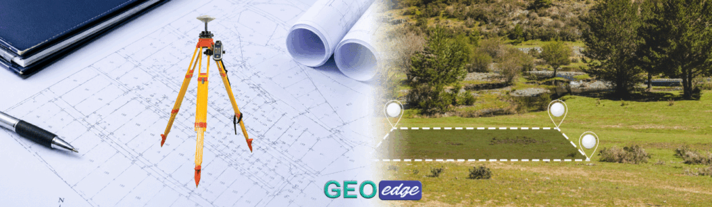
The surveyor visits the property and carries out the required measurements using appropriate equipment.
Step 5: Data Processing and Analysis
Field observations are processed and compared against the relevant survey information.
Step 6: Deliverables
Depending on the assignment, you may receive:
- Coordinates
- Survey plan
- Topographical plan
- Report
- Beacon schedule
- CAD drawings
- Other relevant survey documentation
How Do You Choose the Right Surveyor?
Do not choose solely based on a recommendation from a friend or the lowest price. Ask about:
- Professional qualifications
- Licensing and registration
- Relevant experience
- Previous similar projects
- Survey methodology
- Equipment
- Deliverables
- Cost
- Expected completion time
The Institution of Surveyors of Kenya identifies land surveying as one of the major disciplines within Kenya’s surveying profession and provides professional-sector information through its membership and Land Surveyors Board links.
Why Local Knowledge Matters
Kajiado is not one uniform property market. Land records, development patterns, accessibility, terrain and subdivision activity can differ considerably from one locality to another. A surveyor who understands the practical realities of working in the county can often identify issues that a client may overlook.
Final Thoughts
Whether you are buying land, developing a home, subdividing property or investigating a boundary issue, hiring a qualified land surveyor in Kajiado County can help you make decisions based on proper survey information.
At GeoEdge Land Surveyors, we provide professional surveying and geospatial services tailored to the needs of landowners, developers and property investors.
If you have a property in Kajiado County and are unsure which survey service you need, contact GeoEdge and let us discuss the project with you.

