
Boundary Disputes in Kenya: When You Need a Qualified Land Surveyor
Boundary disputes can start with something that appears small.
A fence moves. A neighbour constructs a wall. A beacon disappears. A road appears to cut through the property.
Before long, two neighbours are arguing about where the boundary should be. If you find yourself in this situation, one of the worst things you can do is rely entirely on assumptions. This is where professional land surveying becomes important.
What Is a Land Boundary Dispute?
A boundary dispute occurs when parties disagree about the location, extent or position of a property boundary. Common causes include:
- Missing beacons
- Disturbed beacons
- Incorrect fencing
- Historical subdivision
- Inaccurate measurements
- Encroachment
- Changes in surrounding development
- Conflicting survey information
- Poor understanding of parcel boundaries
When Should You Call a Surveyor?
Consider engaging a qualified surveyor when:
- You cannot locate your beacons
- Your neighbour disputes the boundary
- A fence appears to be in the wrong position
- You suspect encroachment
- Your property dimensions appear inconsistent
- You are preparing to construct a boundary wall
- A neighbouring development appears to cross your boundary
- Historical subdivision records are unclear
What Does the Surveyor Investigate?
A professional surveyor may examine:
- Title information
- Survey plans
- Registry Index Maps
- Mutation forms
- Deed plans where applicable
- Survey control
- Existing beacons
- Neighbouring parcels
- Physical occupation on the ground
- Historical survey information
The State Department for Lands confirms that survey searches can provide information on parcel boundaries, dimensions, beacons and historical changes.
Why Should You Not Move the Fence Yourself?
Suppose you believe your neighbour has occupied two metres of your land. You move their fence back. Later, a survey establishes that the fence was actually in the correct position. You may now have created an even bigger dispute. It is better to establish the facts first.
Can a Surveyor Resolve Boundary Disputes in Kenya?
A surveyor can provide the technical survey evidence necessary to establish or clarify a boundary. However, not every dispute is resolved simply by measuring the land. Where a formal legal dispute exists, legal or administrative processes may also be necessary.
The State Department’s service charter, for example, describes a government process for resolution of certain fixed and general boundary disputes involving ownership proof, RIM information and other documentation.
What If Beacons Are Missing?
Missing beacons do not automatically mean that the boundary is unknown. A surveyor can investigate the relevant records and determine the appropriate procedure for re-establishing the boundary.
What Should You Give the Surveyor?
If possible, provide:
- Title deed
- Parcel number
- Survey plan
- Mutation
- Deed plan
- Previous survey report
- Photographs
- Information about the dispute
- Details of neighbouring parcels
The more information available, the easier it can be to understand the history of the property.
How a surveyor handles a boundary dispute
1. Review the client’s documents
The surveyor first examines documents such as:
- Title deed
- Registry Index Map (RIM) or cadastral map
- Mutation forms
- Survey plans
- Previous survey records
- Beacon certificates, where available
- Previous subdivision records
- Any relevant land-search information
The objective is to understand the parcel’s legal and survey history before going to the ground.
2. Conduct a survey search
Where necessary, an official survey search can be used to obtain information about the parcel, including survey numbers, boundary dimensions, beacons and historical changes. The State Department for Lands provides survey-search services for this purpose.
3. Inspect the existing boundary
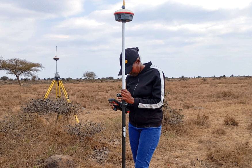
The surveyor visits the property and identifies:
- Existing beacons
- Missing or disturbed beacons
- Boundary walls/fences
- Roads
- Rivers or other physical features
- Neighbouring beacons
- Any apparent encroachment
Importantly, a fence or wall is not automatically the legal boundary. It has to be checked against the survey information.
4. Re-establish or verify the boundary
The surveyor uses the appropriate survey control and official records to determine where the boundary should lie. Depending on the case, this may involve:
- Total station
- GNSS/RTK
- Existing survey control
- Traverse work
- Beacon recovery
- Boundary measurements
- Examination of previous mutations
The surveyor then compares the recorded boundary with the occupation on the ground.
5. Identify the actual problem
For example, you might discover: The neighbour’s fence is approximately 1.5 m inside the client’s parcel. Or: The existing beacon position does not agree with the position derived from the official survey records. Or: A boundary beacon is missing, making it necessary to re-establish the boundary from the survey records. These are very different situations and should not automatically be labelled “encroachment” until the survey evidence supports that conclusion.
6. Prepare a survey report
For a professional boundary-dispute assignment, the report can include:
- Property identification
- Documents examined
- Survey methodology
- Existing boundary features
- Beacon status
- Survey observations
- Coordinates/measurements where appropriate
- Comparison of recorded and ground positions
- Encroachment observations
- Survey plan/sketch
- Photographs
- Conclusion and recommendations
Do Not Turn a Survey Issue Into a Personal Conflict
Land disputes can become emotional very quickly. Try to separate the technical question from the personal disagreement. Instead of: “My neighbour has stolen my land.” Start with: “There is uncertainty about the boundary position, and I need it professionally verified.” That approach gives everyone an opportunity to work with facts.
Final Thoughts
A boundary dispute is not something to ignore. Equally, it is not something to handle through guesswork. A qualified land surveyor in Kenya can investigate the survey evidence and provide professional information about the boundary position.
At GeoEdge Land Surveyors, we approach boundary matters through careful document review, field investigation, measurement and survey analysis. If you have a boundary concern, contact GeoEdge before taking action on the groun

